

Griswold Conservation Area in Blue Mound, IL
- Short 1/2 mile trail connects site with the city of Blue Mound, Illinois
- Glacial kame provides spectacular views
- Pavilion, picnic areas, playground
- Map of Griswold Conservation Area
- Map of Conservation Areas
Griswold Conservation Area is located 1.5 miles northwest of Blue Mound, Illinois in southwest Macon County [get directions]. Griswold Conservation Area’s GPS Coordinates are 39.703954 N, 89.139914 W.
The site features one of the glacial kame “mounds” of the Blue Mound area. Through the efforts of Blue Mound area citizens and civic groups, and the Macon County Conservation District, this 45-acre site has become an attractive recreational and educational facility and provides much-needed wildlife habitat.
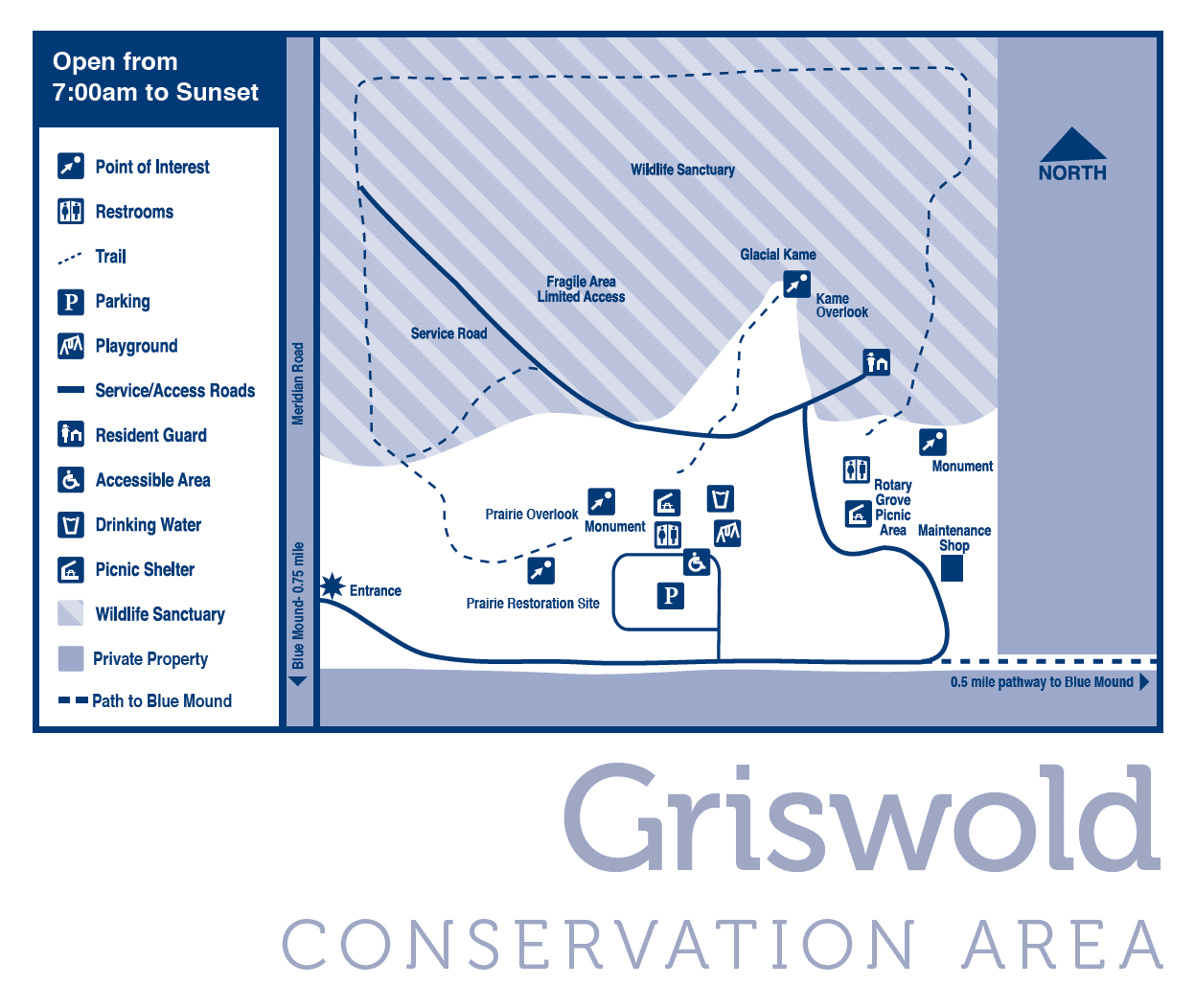
Griswold Conservation Area Map
(click for an enlarged view)

Geological History
Griswold Conservation Area has an interesting geologic history. The tall mound, formed by the glaciers, rises 80 feet above the surrounding farmland. At 706 feet above sea level, it is the second highest point in Macon County and provides spectacular views. On a clear day you can see four counties.
The mound is a glacial kame, or a cone-shaped hill of gravel that forms as a glacier melts. Kames form at intersections of ice crevices as water, carrying gravel from on top of the glacier, drains through the crevice. This kame was left behind with the melting of the lllinois glacial episode 75,000 years ago.

Wildlife Sanctuary
The north portion of Griswold Conservation Area is now a wildlife sanctuary. A surprising number of wildlife species inhabit or visit the site. Many birds nest in the cliffs or stop at Griswold Conservation Area during migration. Hawks and owls hunt the park’s abundant field mice, moles, ground squirrels, and rabbits. Other wildlife observed at the “mound” include groundhogs, skunks, opossums, deer, foxes and coyotes.
Upcoming Events at Griswold
Programs
You can schedule natural history programs for your group at Griswold Conservation Area. Call 217-423-7708 for more information.
