

Sand Creek Conservation Area in Decatur, IL
- Over 7.5 miles of hiking and horseback trails
- Lincoln traveled Paris–Springfield Road at Sand Creek
- Horse trailer parking pads with picnic, grills, and hitching racks
- Map of Sand Creek Conservation Area
- Map of Conservation Areas
Sand Creek Conservation Area is a 794-acre open space site, located just south of Decatur, off South Franklin Street [get directions]. Sand Creek’s GPS Coordinates are 39.786696 N, 88.954273 W.
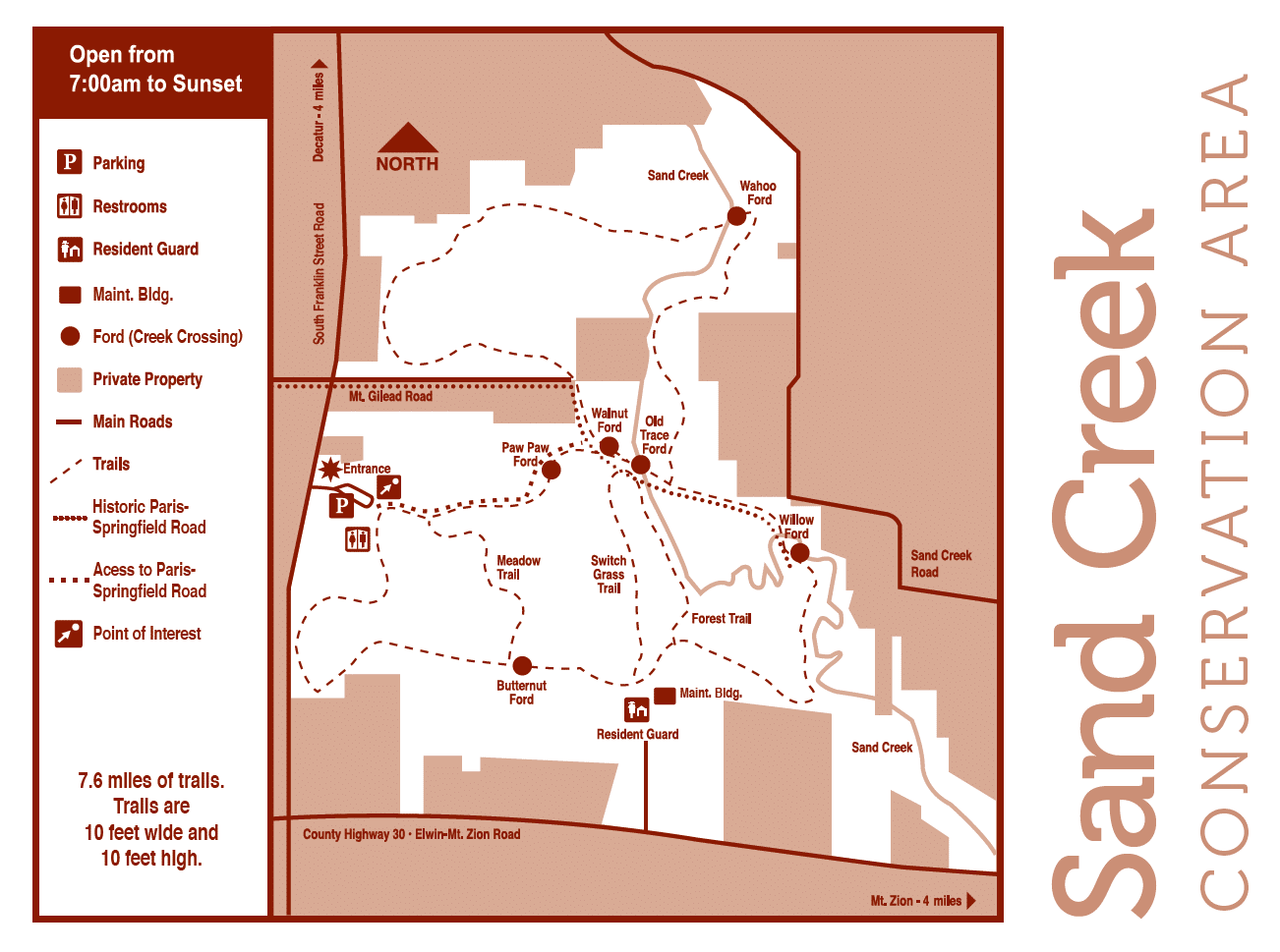
Sand Creek Conservation Area Map
(click for an enlarged view)
Things to do at Sand Creek Conservation Area
Sand Creek is primarily known for its hiking and horse trail that winds through forest, open prairie, and floodplain. In addition to wildlife and natural habitat, part of the historic Paris-Springfield Road passes through the grounds.
The Paris-Springfield Road
The historic Paris-Springfield Road, established in 1824, ran through part of what is now Sand Creek Conservation Area. Among the many people moving west in the early nineteenth century, Abraham Lincoln and his family traveled this section of the road when coming to Decatur from Indiana in March of 1830. Westward travelers going to California and Oregon continued to use the road in the 1840s and 1850s. Trail signs stand along the old roadbed for those who wish to walk in “Mr. Lincoln’s footsteps.”
Horseback Riding Trails
The 7.6-mile horse trail winds its way through the varied habitats of the site, with six fords crossing parts of Sand Creek. The equestrian trail is 10 feet wide and 10 feet high. Eighteen limestone parking pads, measuring 10 feet by 40 feet, are located at the park entrance. Each pad includes a picnic table, grill, and a hitching rack.
Programs & Events at Sand Creek Conservation Area
Programs
You can schedule natural and cultural history programs at Sand Creek Conservation Area by calling 217-423-7708.